|
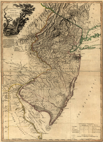
Geographical Land MapThis map encompasses the geographical terrain of colonial New Jersey. There are mountains in the northeast region, the Appalachian Highlands, with lowlands and plains from Lake Ontario all along the Canadian Border. The eastern border consists of the Atlantic Coastal plain. The Delaware river runs on the border of New jersey, allowing the colonists to trade with other colonies.
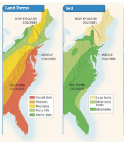
In general, the geography of Middle Colonies, including New Jersey, has a mixture of New England and Southern Colony features, but has fertile soil complete with land suitable for farming. Many natural resources can be found in New Jersey including timber, furs, and coal. Iron ore was a particularly valuable resource, used in many different products such as plows, tools, kettles, locks, nails, and large blocks of iron which were exported to England. |
Climate
There are warm summers and mild winters (less severe winters than New England colonies, cooler summers than Southern colonies). The climate, combined with fertile soil and the general geography, makes New Jersey ideal for farming.
Two major urban centers are Trenton and Princeton.
Two major urban centers are Trenton and Princeton.
